Projects now. Publications soon...
OpenIR
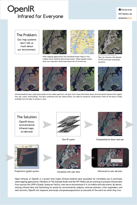
"OPEN INFRARED: A Real-Time Environmental Visualization System for Environmental Analysis, Planning, and Response," will be a visualization system that shows, through infrared satellite data, environmental features that are not visible to the naked eye or even through true-color aerial images. OpenIR's initial dataset is that of the LANDSAT satellite, available from the University of Maryland's Global Landcover Facility (http://glcf.umiacs.umd.edu/).
OpenIR will a tool that supports efforts at ecological and environmental sustainability.
OpenIR is in its very early stages, but I and Ilias Koen, my collaborator at DuKode, are currently building the team, setting up the server, and experimenting with client builds. To see a bigger version of the poster above, see the "Featured Work" at the bottom of the "Process" sidebar.